Zhangjiajie Avatar Mountains Drone Photography: What It’s Like to Fly Above the Floating Pillars
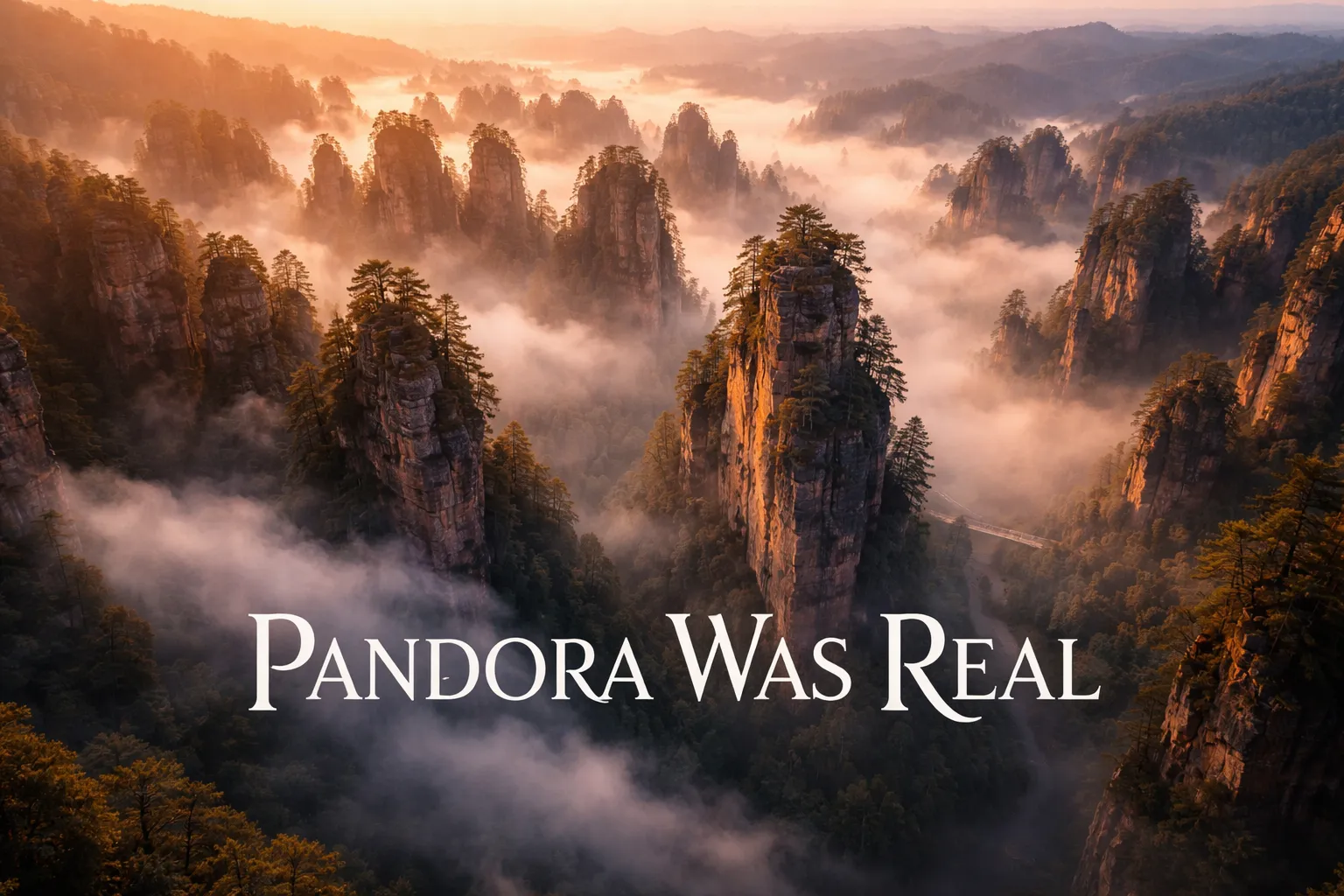
What actually happens when a drone clears the treeline above Yuanjiajie Scenic Area for the first time? Your stomach drops and your breath catches before your brain even processes the image on the controller screen. No photograph, no film clip, no secondhand description prepares anyone for what zhangjiajie avatar mountains drone photography looks like when you’re watching it unfold live. More than 3,000 quartzite sandstone pillars, some climbing 200 meters straight out of the valley floor, spread across the terrain in every direction like a petrified army of stone sentries. It was a Tuesday morning in late October when I flew this, and the mist behaved exactly the way it’s supposed to — settling at mid-elevation between the columns until the upper pillars seemed to be floating free of the earth entirely. James Cameron didn’t have to invent Pandora’s Hallelujah Mountains. He barely had to embellish. The real version sits in Hunan Province, China, and from altitude it’s one of the strangest, most disorienting sights you can point a camera at.
This guide walks through everything required to plan a legal, safe, and genuinely spectacular drone session at Zhangjiajie National Forest Park — the exact compositions professional filmmakers rely on, the technical headaches nobody mentions ahead of time, and a straight answer on where China’s drone regulations actually stand in this region.
Quick-Reference Flight Data: Zhangjiajie National Forest Park
| Parameter | Details |
|---|---|
| GPS Coordinates (Tianzi Mountain Viewpoint) | 29.3716° N, 110.4536° E |
| GPS Coordinates (Yuanjiajie Scenic Area) | 29.3253° N, 110.4378° E |
| Recommended Altitude Range | 80–180m AGL for pillar-level shots; 200–350m for full forest canopy overview |
| Best Time of Day | 6:00–9:00 AM for morning mist; golden hour at 5:00–6:30 PM for warm pillar light |
| Best Season | Late September–November (autumn mist); March–May (spring fog); January–February (snow-capped pillars) |
| Drone Regulations Summary | CAAC registration mandatory for drones over 250g; commercial filming requires advance permits from park authorities; flying within the core scenic zones is heavily restricted — see full regulations section below |
| Skill Level Required | Advanced — unpredictable mountain thermals, GPS signal interference between pillars, extreme vertical terrain |
| Nearest Major Airport | Zhangjiajie Hehua International Airport (DYG), approx. 35 km from park entrance |
Is Drone Flight Actually Permitted at Zhangjiajie? The Regulatory Landscape
I’m going to give you the version most aerial photography blogs skip past entirely: launching a drone inside Zhangjiajie National Forest Park’s core scenic zones without pre-approval is against the rules, and enforcement has tightened considerably since 2019. China’s Civil Aviation Administration (CAAC) mandates registration and licensed operation for any drone over 250 grams. On top of that federal layer, the park itself — a UNESCO Global Geopark since 1992 — runs its own separate set of restrictions, and the two frameworks apply simultaneously, not as alternatives.
Here’s what the current published guidance actually demands: (1) Your drone needs to be registered in CAAC’s UAS Cloud system before it ever enters Chinese airspace with you. (2) Any commercial or media drone work inside the park requires a filming permit (影视拍摄许可证), applied for through the Zhangjiajie National Forest Park Administration Bureau, with a typical 15–30 day processing window. (3) Tianzi Mountain and Yuanjiajie both fall inside a designated sensitive flight zone, so DJI’s automated geo-fencing will restrict or flag your aircraft the moment you approach. (4) Even with paperwork fully sorted, flights still need coordination with local rangers and are generally confined to designated launch points set back from the pedestrian trail corridors.
Here’s the reality on the ground for independent travelers: nearly all the jaw-dropping drone footage of Zhangjiajie circulating online came from one of three sources — credentialed film crews working with advance permits, footage shot from positions just outside the strict boundary line, or, bluntly, unauthorized flights that broke park rules. I’m not suggesting the third option. What I am saying is the permit route, while slow and paperwork-heavy, is genuinely workable. A number of tour operators based in Zhangjiajie City specialize in arranging filming permits for foreign crews, and going through one is by far the most dependable legal route to avatar mountains china drone flying. Give yourself a minimum of three weeks for the permit to clear, and expect to hand over a detailed flight plan, crew credentials, and a shoot schedule as part of the application.
What Zhangjiajie Reveals From the Air That the Trails Never Show You
Walking the trails at Zhangjiajie is genuinely stunning, but it hands you the pillars one at a time, neck craned upward, your view limited to whatever gap in the forest canopy you happen to be standing beneath. The zhangjiajie national park aerial view gives you a completely different read on the landscape. At 150 meters above the valley floor, the pillar forest stops looking like a collection of separate rock formations and starts reading as a single system — a kind of geological organism running from horizon to horizon. For the first time you can actually trace how natural stone bridges link the pillar tops like walkways, how twisted Huangshan pines somehow root themselves into columns with almost no visible soil, and how the whole formation is really the leftover skeleton of a once-massive sandstone plateau. The valleys mark where the rock eroded away; the pillars are simply what didn’t.
At dawn, once the mist settles around 800–1,000 meters — roughly the midpoint of the tallest pillars — the aerial view produces precisely the visual effect that made Avatar’s floating-mountain sequences so memorable: pillar tops rising out of a white sea of cloud, completely severed, visually, from the ground beneath them. There’s no post-processing trick or clever angle involved. That’s simply what it looks like at 7 AM on a humid autumn morning, viewed from 200 meters up. The Tianzi Mountain drone photography spots zero in on the densest cluster of pillars anywhere in the park, a section known as the “Tianzi Mountain Sea of Clouds,” where more than a dozen major formations top 1,200 meters and the mist behaves with the most consistency and drama.
One thing caught me off guard from up there: just how much green there is. Standing on the ground, the rock is what dominates your attention. From above, the pillars turn out to be almost entirely wrapped in forest — the stone only shows itself on the sheer vertical faces, which from altitude read as thin grey seams cutting through dense green canopy. Shot in early morning light, the contrast between weathered sandstone and subtropical pine takes on a saturation that almost looks unreal.
Signature Compositions Worth Chasing at Zhangjiajie
The Mist-Layer Shot (Altitude: 180–250m, Early Morning)
Position the drone just above the top of the mist so the pillar summits poke out over a flat white plane of cloud. The strongest framing puts three to five pillar tops in the foreground at staggered distances, with cloud stretching to the horizon behind them. Shoot at a 24mm equivalent focal length with a slight downward tilt — 10 to 15 degrees — to preserve the sense of height. This works best from the Tianzi Mountain area between 6:30 and 8:30 AM, ideally in October or November. On exposure: protect your highlights on the mist first, because it blows out fast once the sun climbs.
The Glass Bridge, Shot From Directly Overhead (Altitude: 100–150m, Midday)
The Zhangjiajie Grand Canyon Glass Bridge — 430 meters long, hanging 300 meters above the canyon floor — is already one of the most photographed structures on earth, yet the glass bridge zhangjiajie from above angle rarely turns up outside professional productions. Hovering directly overhead at 120 meters, the bridge reads as an impossibly thin thread strung across the void, with the canyon walls falling away symmetrically on both sides. The glass floor panels disappear entirely from that height, which makes the people walking across it look like they’re levitating over the gorge with nothing beneath them. Pulling this off requires solid hover stability in a canyon environment full of significant updrafts — not a shot for a first-time flyer. The bridge sits at 29.2447° N, 110.3941° E, inside its own management zone with permit requirements separate from the rest of the national forest park.
Snow-Capped Pillars in Winter (Altitude: 150–200m, January–February)
Manage to time a shoot within the two-to-four-week window each year when snow settles on the pillar tops, and you’re looking at maybe the rarest, most visually striking version of this landscape from above. White snow caps sitting on dark sandstone against a pale winter sky create a nearly monochromatic palette that has nothing in common with the summer or autumn shots. Tianzi Mountain gets the most reliable snowfall of any section. Cold really hurts battery performance here too — lithium cells lose 20 to 30 percent of their capacity at 0°C, so pack spares and keep them warm in an inner jacket pocket until you’re ready to swap in.
The “Avatar Tree” Pillar (Hallelujah Mountain, Altitude: 120m)
Pillar No. 3015, officially rebranded “Avatar Hallelujah Mountain” in 2010 after the film’s release, is a 150-meter sandstone column with a distinctive lean to it. From the ground it’s already impressive. From 120 meters, positioned slightly below its summit and looking up along the face with the valley behind, it becomes the single most recognizable image in all of Zhangjiajie aerial photography. The closest legal launch point sits around 29.3178° N, 110.4312° E, though you’ll need your permit coordinator on site to confirm it before you fly.
Why Flying at Zhangjiajie Is Harder Than It Looks
Let me be precise about this, because the technical conditions at Zhangjiajie don’t resemble any other landscape I’ve flown in. First, wind: the canyon system running between the pillars generates localized thermals and directional shifts that have zero relationship to whatever your weather app told you on the ground. I once watched my controller register 4 km/h while a pine at the top of a nearby pillar thrashed in what was obviously a 25+ km/h gust, 80 meters away. Keep 40 percent battery in reserve at all times to fight unexpected headwinds on the way back. Second, GPS interference: the quartzite sandstone contains ferrous mineral deposits, and navigating the narrow corridors between pillars causes real positioning instability in some aircraft. Several professional operators I talked to in Zhangjiajie described their drones dropping into ATTI mode — no GPS stabilization — when flying close to pillar faces, a situation that demands real manual piloting and isn’t something a beginner can recover from. Third, depth perception: with everything in frame running vertical and no horizontal reference points anywhere, judging your true distance from a rock face on a 5-inch screen is genuinely hard. Treat your drone’s obstacle avoidance as a last-resort safety net rather than a crutch, and hold at least 15 meters of clearance from any rock face, no exceptions.
Collision Lights: Non-Negotiable Gear for Flying Among These Pillars
Sending a drone up above thousands of towering sandstone columns puts you in genuinely chaotic three-dimensional airspace, where collision risk stacks up fast. Between the rock formations themselves, sudden wind shear, and the sheer visual confusion of operating close to massive vertical obstacles, a strobe light that keeps your drone visible — to other aircraft, and to your own eyes when the sun’s hitting the canyon walls — stops being optional and becomes basic safety equipment.
What worked
- The brightness cuts through canyon shadow and afternoon glare well enough that your eyes can actually track it — I could pick my drone out against the limestone cliffs from far greater distances than I could without it.
- Power draw is close to nothing, which matters a lot when you’re stacking multiple flights across a huge scenic area and already stretching your battery reserves thin.
- Mounting it took under two minutes, and it stayed put through aggressive banking around rock formations — no shifting, no rattling.
Where it falls short
- Direct sunlight genuinely washes the light pattern out unless you’re looking right at it — it earns its keep most on overcast days or during dawn and dusk flights.
- You still have to know the local drone rules inside and out; a strobe light does nothing to untangle the permit process or the restricted airspace, and Zhangjiajie hands you plenty of both.
I almost ditched it halfway through my Zhangjiajie trip because the midday sun seemed to render it useless, but switching to early-morning flights proved the strobe was absolutely worth the weight. Grab the VIFLY Drone Strobe Light Anti Collision Light before you head to the canyon.
Frequently Asked Questions
Do I need a permit to fly a drone at Zhangjiajie National Forest Park?
Yes. Any commercial or media drone work requires a filming permit (影视拍摄许可证) from the Zhangjiajie National Forest Park Administration Bureau, with a typical 15–30 day processing window. Additionally, your drone must be registered in CAAC’s UAS Cloud system before entering Chinese airspace, and drones over 250 grams require CAAC registration and licensed operation.
What are the best times to fly drones at Zhangjiajie for mist shots?
Early morning is ideal, specifically 6:00–9:00 AM for morning mist. The best seasons are late September–November for autumn mist and March–May for spring fog. Mist typically settles at around 800–1,000 meters elevation, which is roughly the midpoint of the tallest pillars.
What altitude should I fly at to photograph Zhangjiajie’s pillar formations?
Fly between 80–180 meters above ground level for pillar-level shots, or 200–350 meters for a full forest canopy overview. Specific compositions vary: the mist-layer shot works best at 180–250 meters, the glass bridge shot at 100–150 meters, and the Avatar Tree pillar at 120 meters.
What equipment do I need to safely fly at Zhangjiajie?
A collision light is essential safety gear in this complex three-dimensional airspace. The VIFLY Drone Strobe Light Anti Collision Light helps you track your drone against limestone cliffs and canyon shadows. You’ll also need extra batteries—lithium cells lose 20 to 30 percent of their capacity at 0°C in winter, so pack spares and keep them warm in an inner jacket pocket.
About This Article

Written by Elena Vasquez. Elena Vasquez is a full-time traveler and the founder of Witty Passport. Over fifteen years and more than 50 countries across six continents — including a stretch spent leading groups professionally through Southeast Asia and the remote highlands of South America — she's written the kind of destination guides she always wished existed: practical, specific, and built on real experience rather than recycled itineraries. More about this site.
Scope and limits. Elena is a full-time traveler, not a licensed travel agent or immigration adviser. Entry requirements, visa rules, and advisories change without notice — always confirm against the official government source for your destination and passport before booking.
Verify this against a primary source
Specifics change, and your situation may differ from the one described here. These are the authorities worth checking directly:
- U.S. Department of State — entry requirements and travel advisories
- CDC Travelers' Health — vaccination and health notices by destination
- TSA — current carry-on and screening rules